Galuchat GIS SDK

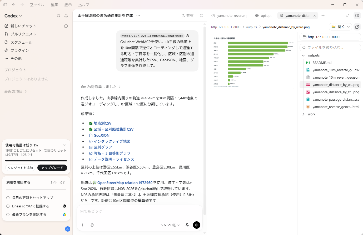
CodexがGaluchat WebMCPで山手線沿線を逆ジオコーディングし、集計CSV、GeoJSON、地図、グラフを作成した画面
山手線の軌道を10m間隔で検索し、通過区域の集計と成果物を作成した例です。画像はローカル開発環境での実行例ですが、公開版は https://nyatla.github.io/galuchat/mcp/ から利用できます。This example resolves the Yamanote Line at 10-meter intervals and produces area summaries and output files. The image shows a local development run; use the published version at https://nyatla.github.io/galuchat/mcp/.

最新のChatGPTデスクトップアプリと、サイトツールが有効なモデルを使用してください。OpenAIの現行案内ではGPT-5.6 SolまたはGPT-5.6 Terraが対象です。提供状況はロールアウトやワークスペースによって異なるため、OpenAI公式のサイトツール案内も確認してください。Use the latest ChatGPT desktop app and a model with site tools enabled. OpenAI currently lists GPT-5.6 Sol and GPT-5.6 Terra. Availability can vary by rollout and workspace; see the official OpenAI site-tools guide.

01

03

04

galuchat_get_api_spec

galuchat_resolve_position

galuchat_resolve_positions

galuchat_resolve_code

galuchat_resolve_codes

galuchat_get_code_map

経度139.7671、緯度35.6812をN03 2026で逆ジオコーディングしてください。Reverse-geocode longitude 139.7671 and latitude 35.6812 using N03 2026.

山手線の軌道上を10m間隔で逆ジオコーディングして通過する町名・丁目等を一覧化し、区域・区別の通過距離を集計したCSV、GeoJSON、地図、グラフ画像を作成して。Reverse-geocode points along the Yamanote Line tracks at 10-meter intervals, list the towns, chome, and other areas it passes through, calculate the distance traveled through each area and ward, and create a CSV, GeoJSON, map, and graph image.

経度121.5654、緯度25.0330をtw-2026-maps-nlsc-gov-tw-village-adm-rev1で逆ジオコーディングしてください。Reverse-geocode longitude 121.5654 and latitude 25.0330 using tw-2026-maps-nlsc-gov-tw-village-adm-rev1.

ロンドンの経度-0.1276、緯度51.5072をgb-2025-geoportal-statistics-gov-uk-lad-adm-bfc-rev1で逆ジオコーディングしてください。Reverse-geocode London at longitude -0.1276 and latitude 51.5072 using gb-2025-geoportal-statistics-gov-uk-lad-adm-bfc-rev1.

蘇我駅から1km以内にある丁目をすべて列挙して。List all chome within 1 km of Soga Station.